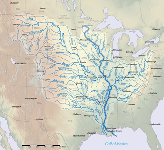
List of longest rivers of the United States

The longest rivers of the United States include 38 that have main stems of at least 500 miles (800 km) long. The main stem is "the primary downstream segment of a river, as contrasted to its tributaries". The United States Geological Survey (USGS) defines a main-stem segment by listing coordinates for its two end points, called the source and the mouth. Some well-known rivers like the Atchafalaya, Willamette, and Susquehanna are not included in this list because their main stems are shorter than 500 miles.
Seven rivers in this list cross or form international boundaries. Three—the Milk River, the Red River of the North, and the Saint Lawrence River—begin in the United States and flow into Canada; two do the opposite (Yukon and Columbia). Also a segment of the Saint Lawrence River forms the international border between part of the province of Ontario, Canada, and the U.S. state of New York. Of these seven rivers, only the Milk River crosses the international border twice, leaving and then re-entering the United States. Two rivers, the Colorado and the Rio Grande, begin in the United States and flow into or form a border with Mexico. In addition, the drainage basins of the Mississippi and Missouri rivers extend into Canada, and the basin of the Gila River extends into Mexico.
Sources report hydrological quantities with varied precision. Biologist and author Ruth Patrick, describing a table of high-discharge U.S. rivers, wrote that data on discharge, drainage area, and length varied widely among authors whose works she consulted. "It seems," she said, "that the wisest course is to regard data tables such as the present one as showing the general ranks of rivers, and not to place too much importance on minor (10–20%) differences in figures."
Table
The primary source for watershed and discharge data in the table below is Rivers of North America. Conflicting data from other sources, if the difference is greater than 10 percent, is reported in the notes. Discharge refers to the flow at the mouth. In the "States, provinces, and map" column, the superscripts "s" and "m" indicate "source" and "mouth". Non-U.S. states appear in italics. Except in the "States, provinces, and map" column, abbreviations are as follows: "km" for "kilometer", "mi" for "mile", "s" for "second", "m" for "meter", and "ft" for "foot".
Map

See also
- List of rivers of the United States
- List of rivers of the United States by discharge
- List of longest rivers in the United States by state
- List of rivers by length
Notes
References
Works cited
- Benke, Arthur C.; Cushing, Colbert E. (2005). Rivers of North America. Burlington, Massachusetts: Elsevier Academic Press. ISBN 978-0-12-088253-3.
- Patrick, Ruth (1995). Rivers of the United States: Volume II: Chemical and Physical Characteristics. New York: John Wiley & Sons. p. 24. ISBN 978-0-471-10752-1.