Tagichinor

Tagichinor
Landscape near Tagichinor
Tagichinor is located in Tajikistan
Tagichinor
Tagichinor
Location in Tajikistan
Coordinates: 39°11′54″N 69°07′03″E / 39.19833°N 69.11750°E / 39.19833; 69.11750
Country Tajikistan
RegionSughd Region
DistrictAyni District
Elevation
2,600 m (8,500 ft)
Population
 (2017)
 • Total
32
Official languages

Tagichinor (Russian: Раут or Russian: Тани Чанор; Tajik: Тагичинор, Yaghnobi Роԝут Rowut, Роԝт[citation needed] or Таги Чанор, Таги Чинор) is a village in Sughd Region, northwestern Tajikistan. It is part of the jamoat Anzob in the Ayni District. Its population was 32 people as of 2017,[better source needed] up from 18 in 2007.

The name means "under the sycamore tree".[better source needed]

Geography

Tagichinor sits at an altitude of approximately 2,600 metres (8,500 ft) above sea level.[better source needed] It is situated above the right, northern bank of the River Yaghnob. Tagichinor is located 85 kilometres (53 mi) from the center of the jamoat Anzob, and 123 kilometres (76 mi) from the center of the Ayni District.[better source needed]

Demographics

Historical population
YearPop.±% p.a.
1870 27—    
1887 12−4.66%
1904 13+0.47%
1927 13+0.00%
1941 17+1.93%
1969 14−0.69%
1995 6−3.21%
2007 18+9.59%
2017 32+5.92%
Source: [better source needed]

Its population was 32 people as of 2017,[better source needed] up from 18 in 2007.

References

  1. ↑ "КОНСТИТУЦИЯ РЕСПУБЛИКИ ТАДЖИКИСТАН". prokuratura.tj. Parliament of Tajikistan. Retrieved 9 January 2020.
  2. 1 2 3 4 5 6 Деҳаи Таги чинор [Village of Tagi Chinor]. tojkiston.ucoz.ru (in Russian). Archived from the original on 2024-12-22. Retrieved 2025-03-16.
  3. 1 2 3 "Brief Scientific Feasibility Study and Proposed Pre-Project Activities for Establishing the Yaghnob Natural Ethnography Park" (PDF) (in Russian). Тajik Social-Ecological Union (ТСОЭС). 2007. p. 42. Archived from the original (PDF) on 2018-12-22. Retrieved 2025-03-16.
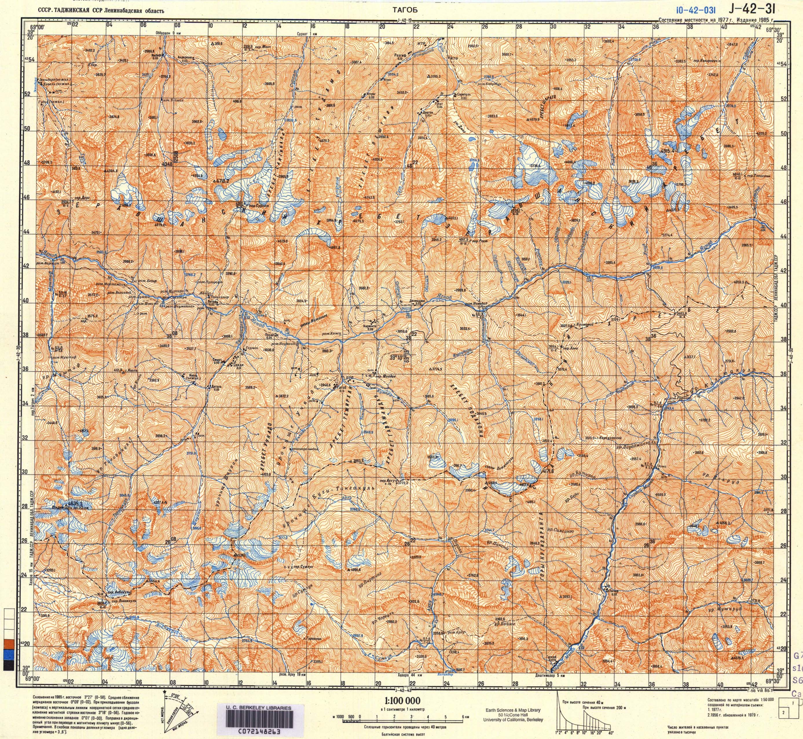
  4. ↑ Soviet military map J-42-31 (1:100,000)