| Gerstheim comune | |
|---|---|
  | |
 | |
| Localizzazione | |
| Stato |  Francia |
| Regione | Grand Est |
| Dipartimento |  Basso Reno |
| Arrondissement | Sélestat-Erstein |
| Cantone | Erstein |
| Amministrazione | |
| Sindaco | Julien Koegler |
| Territorio | |
| Coordinate | 48°23′N 7°43′E |
| Altitudine | 149, 157 e 154 m s.l.m. |
| Superficie | 16,42 km² |
| Abitanti | 3 449 (2019) |
| Densità | 210,05 ab./km² |
| Comuni confinanti | Daubensand, Erstein, Obenheim, Schwanau (DE-BW) |
| Altre informazioni | |
| Cod. postale | 67150 |
| Fuso orario | UTC+1 |
| Codice INSEE | 67154 |
| Cartografia | |
  Gerstheim | |
| Sito istituzionale | |
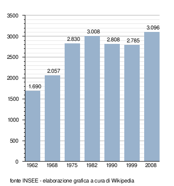
Gerstheim (Geerschte nel dialetto locale) è un comune francese di 3 449 abitanti situato nel dipartimento del Basso Reno nella regione del Grand Est.