Sharon Springs, Kansas
Sharon Springs, Kansas | |
|---|---|
City and County seat | |
 Wallace County Courthouse (2010) | |
 Location within Wallace County and Kansas | |
 | |
| Coordinates: 38°53′40″N 101°45′04″W / 38.89444°N 101.75111°W | |
| Country | United States |
| State | Kansas |
| County | Wallace |
| Founded | 1868 |
| Incorporated | 1890 |
| Named for | Sharon Springs, New York |
| Area | |
| • Total | 0.90 sq mi (2.34 km2) |
| • Land | 0.90 sq mi (2.34 km2) |
| • Water | 0.00 sq mi (0.00 km2) |
| Elevation | 3,442 ft (1,049 m) |
| Population (2020) | |
| • Total | 751 |
| • Density | 830/sq mi (320/km2) |
| Time zone | UTC-7 (Mountain (MST)) |
| • Summer (DST) | UTC-6 (MDT) |
| ZIP code | 67758 |
| Area code | 785 |
| FIPS code | 20-64375 |
| GNIS ID | 2395858 |
| Website | Info |
Sharon Springs is a city in Wallace County, Kansas, United States. It is also the county seat Wallace County. In 2020, 751 people lived there.
History
Sharon Springs was first called Eagle Tail station when it was created in 1868. It was renamed Sharon Springs in 1886, after Sharon Springs, New York. Sharon Springs was incorporated as a city in 1890.
In 2013, the biggest sinkhole in Kansas opened north of Sharon Springs. As of December 2013, the sinkhole was about 88 feet (27 m) deep and 243 feet (74 m) across.
Geography
Sharon Springs is at 38°53′40″N 101°45′4″W / 38.89444°N 101.75111°W (38.894334, -101.751163). The United States Census Bureau says that the city has a total area of 0.90 square miles (2.33 km2). All of it is land.
Climate
The Köppen Climate Classification system says that Sharon Springs has a semi-arid climate, abbreviated "BSk" on climate maps.
People
| Historical population | |||
|---|---|---|---|
| Census | Pop. | %± | |
| 1890 | 178 | — | |
| 1900 | 180 | 1.1% | |
| 1910 | 440 | 144.4% | |
| 1920 | 815 | 85.2% | |
| 1930 | 792 | −2.8% | |
| 1940 | 760 | −4.0% | |
| 1950 | 994 | 30.8% | |
| 1960 | 966 | −2.8% | |
| 1970 | 1,012 | 4.8% | |
| 1980 | 982 | −3.0% | |
| 1990 | 872 | −11.2% | |
| 2000 | 835 | −4.2% | |
| 2010 | 748 | −10.4% | |
| 2020 | 751 | 0.4% | |
| U.S. Decennial Census | |||
2020 census
The 2020 census says that there were 751 people, 320 households, and 182 families living in Sharon Springs. Of the households, 75.0% owned their home and 25.0% rented their home.
The median age was 47.4 years. Of the people, 88.4% were White, 0.5% were Native American, 0.3% were Black, 0.1% were Pacific Islanders, 4.4% were from some other race, and 6.3% were two or more races. Hispanic or Latino of any race were 7.5% of the people.
2010 census
The 2010 census says that there were 748 people, 327 households, and 197 families living in Sharon Springs.
Infrastructure
Sharon Springs is on U.S. Route 40.
References
- 1 2 3 U.S. Geological Survey Geographic Names Information System: Sharon Springs, Kansas
- 1 2 "2020 U.S. Gazetteer Files". United States Census Bureau. Retrieved November 18, 2023.
- 1 2 3 "DP1: PROFILE OF GENERAL POPULATION AND HOUSING CHARACTERISTICS". United States Census Bureau. Retrieved November 18, 2023.
- ↑ "Find a County". National Association of Counties. Retrieved 2011-06-07.
- ↑ Kansas State Historical Society (1916). Biennial Report of the Board of Directors of the Kansas State Historical Society. Kansas State Printing Plant. p. 310.
- ↑ "Profile for Sharon Springs, Kansas". ePodunk. Archived from the original on 13 January 2017. Retrieved 27 June 2014.
- ↑ Blackmar, Frank Wilson (1912). Kansas: A Cyclopedia of State History, Volume 2. Standard Publishing Company. p. 682.
- ↑ "Kansas Sinkhole". UPI. Retrieved 2013-08-04.
- ↑ "Climate Summary for Sharon Springs, Kansas". Archived from the original on 2019-10-17. Retrieved 2019-11-07.
- ↑ "P16: HOUSEHOLD TYPE". United States Census Bureau. Retrieved January 2, 2024.
- ↑ "American FactFinder". United States Census Bureau. Retrieved 2012-07-06.
Other websites

- City
- City of Sharon Springs Archived 2013-06-20 at the Wayback Machine
- Sharon Springs - Directory of Public Officials
- Wallace County Archived 2019-10-23 at the Wayback Machine, Wallace County economic development alliance
- Wallace County, skyways.lib.ks.us
- Sharon Springs and Wallace County[permanent dead link], kansastowns.us
- Schools
- USD 241, local school district
- Historic
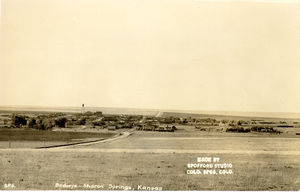
- Historic Photograph of City
- Pet Kansas badger once roamed White House Archived 2013-10-29 at the Wayback Machine, Wichita Eagle
- Maps
- Sharon Springs City Map Archived 2020-05-04 at the Wayback Machine, KDOT
Municipalities and communities of Wallace County, Kansas, United States | ||
|---|---|---|
| Cities |  | |
| Unincorporated communities | ||
| Footnotes | †This community is designated a Census-Designated Place (CDP) by the United States Census Bureau. | |


 This short article about a place or feature in the United States can be made longer. You can help Wikipedia by adding to it.